×
模态框(Modal)标题
在这里添加一些文本
Close
Close
Submit
Cancel
Confirm
×
模态框(Modal)标题
×
Journal
Article
Figure
Search
EN
中文
Home
About Journal
Overview
Indexing
Awards
Editorial Board
Guide for Authors
Browse
Current Issue
Online First
Archive
Highlights
Topic
Archive by Subject
Most Viewed
Most Download
Most Cited
E-mail Alert
RSS
Subscription
Guidelines
Contact Us
EN
中文
Figure/Table detail
Reconstruction and dynamic evolution characteristics of cropland area in Japan over the past millennium
LI Mei-jiao, HE Fan-neng, ZHAO Cai-shan, YANG Fan
JOURNAL OF NATURAL RESOURCES
, 2025, 40(
9
): 2573-2590. DOI:
10.31497/zrzyxb.20250917
耕地方位
耕地面积
分米数
名请人住址
土地所有人
耕地方位
一反小
九斗三升六合
名请人住址
二郎太郎
耕地方位
一反
八斗五升五合
名请人住址
与二郎
耕地方位
一反 稗 大豆
九斗四升五合
名请人住址
与卫门
(以下部分省略)
Table 1
Land survey register of the 11th year of Tenshō (1583) in Konzaike village of Omi province
Other figure/table from this article
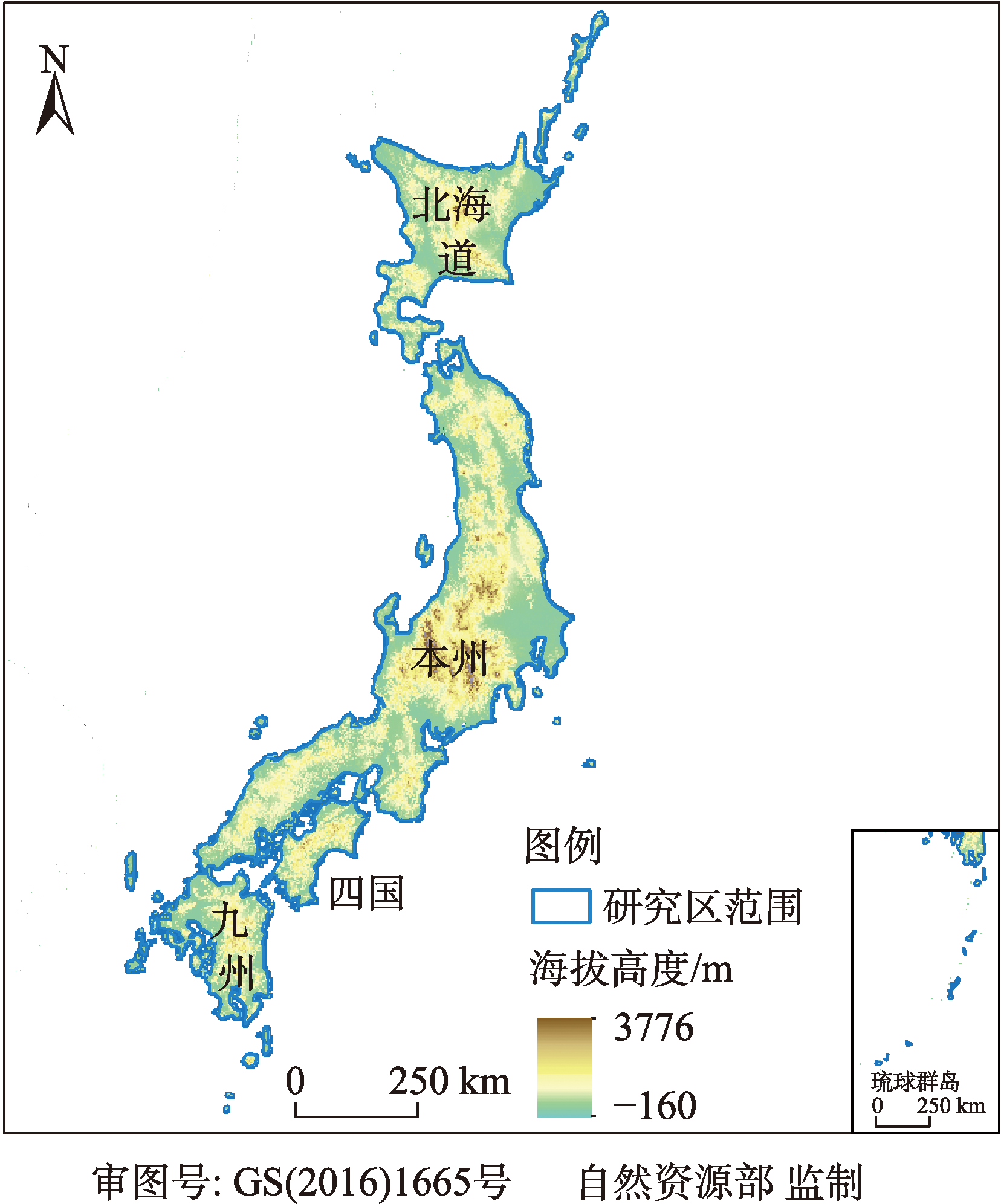
Fig. 1
Schematic diagram of the study area
Fig. 2
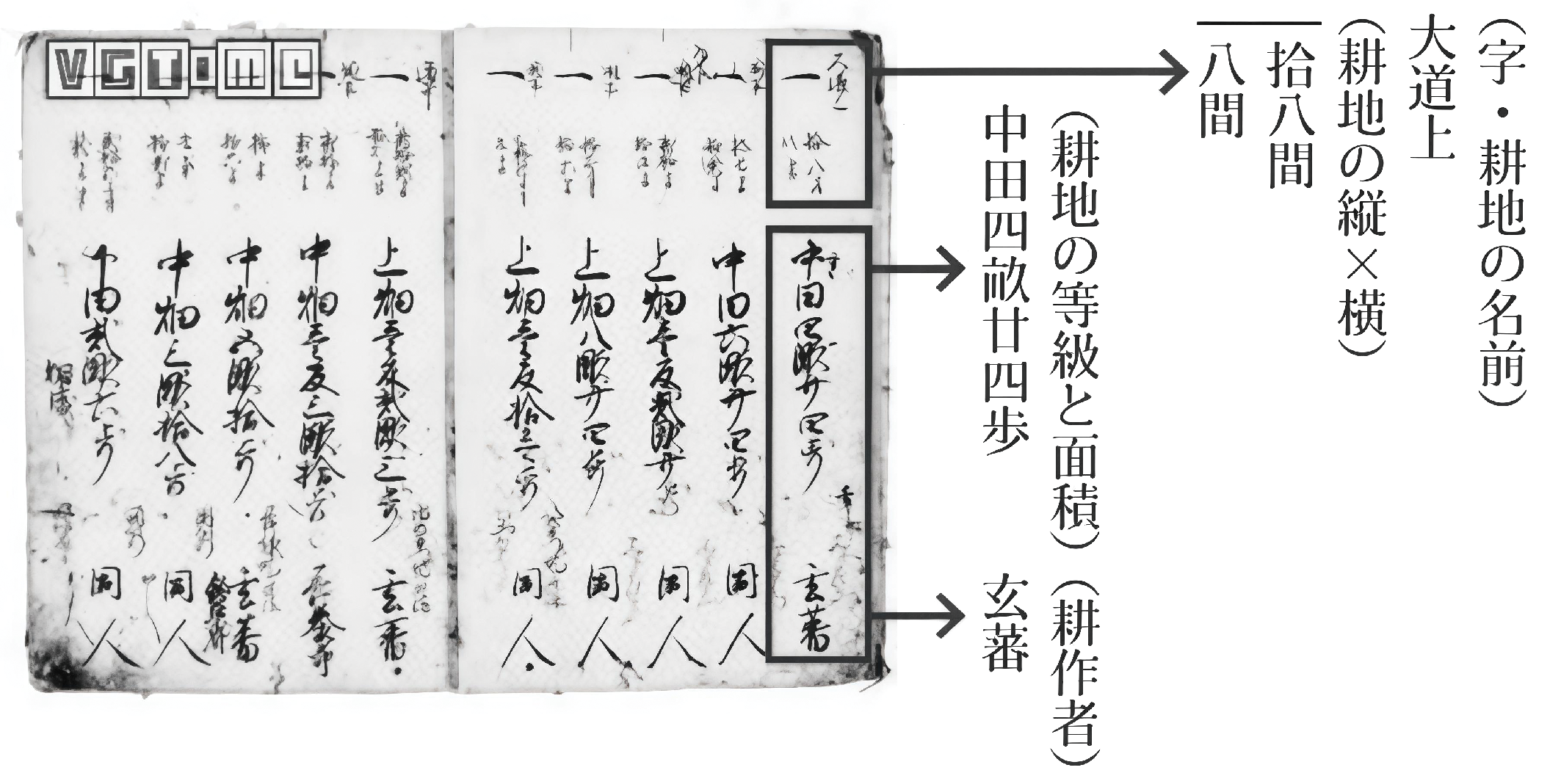
Land survey register of Sunahara village in the 10th year of Genroku (1697)
Fig. 3
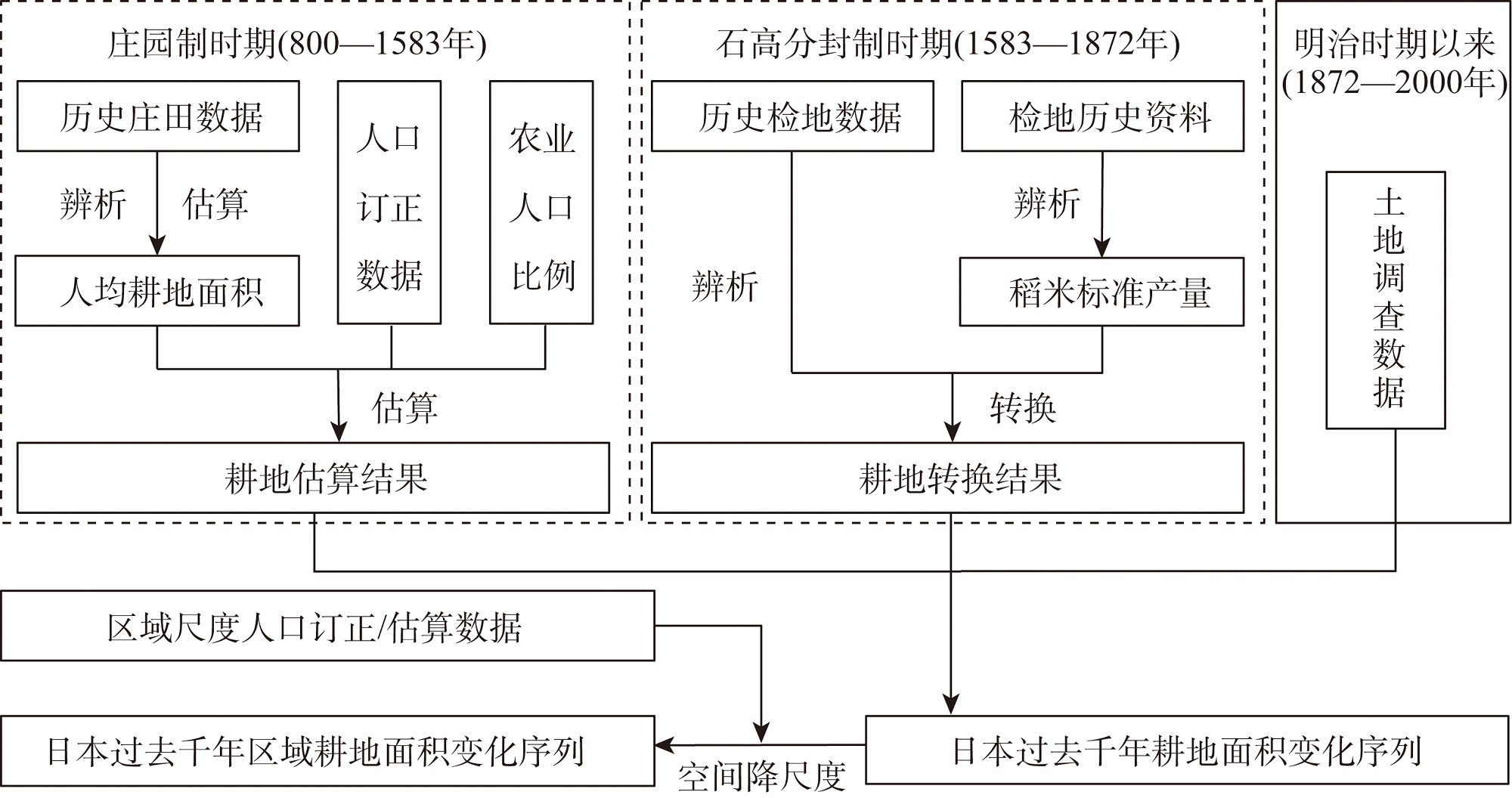
Scheme for reconstruction of cropland area at the regional level of Japan over the past millennium
Table 2
Historical records on agricultural fields of Japan
Table 3
Proportion of agricultural population to the total population in early Meiji-era Japan
Fig. 4
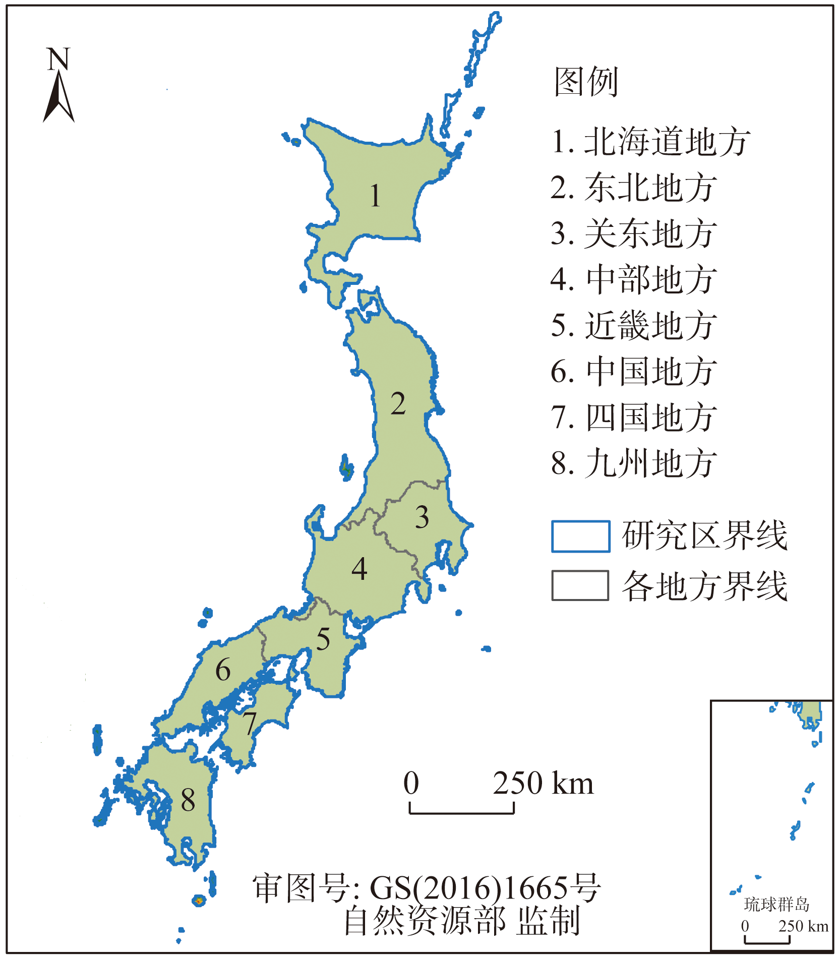
Coordination plan for administrative divisions in Japan
Fig. 5
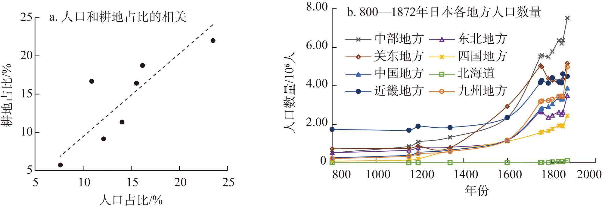
The correlation between the proportion of population and the proportion of cropland in the early Meiji period, and population data of eight regions in Japan from 800 to 1872
Fig. 6
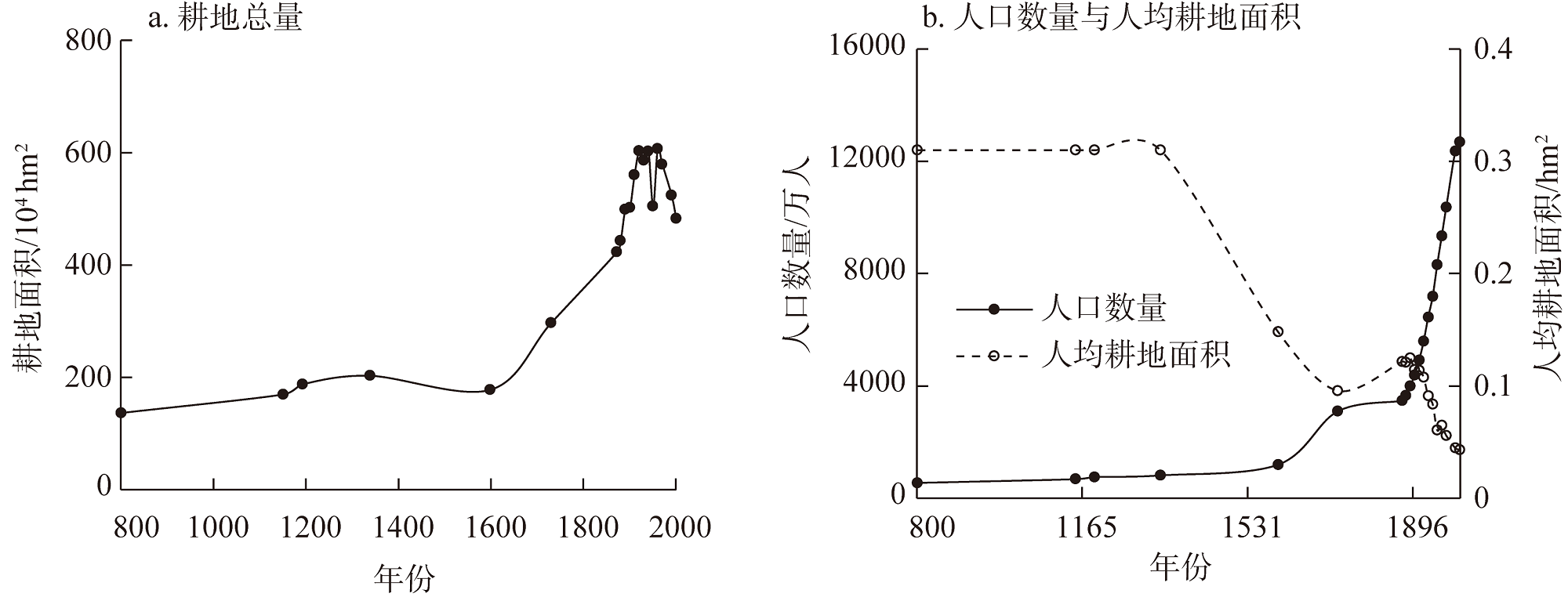
Changes in cropland area, population, and per capita cropland area of Japan over the past millennium
Fig. 7
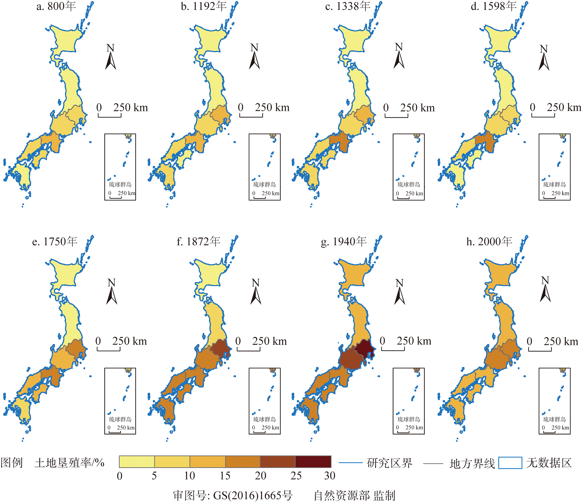
Spatial distribution of reclamation rates in eight regions at typical time points over the past millennium
Fig. 8
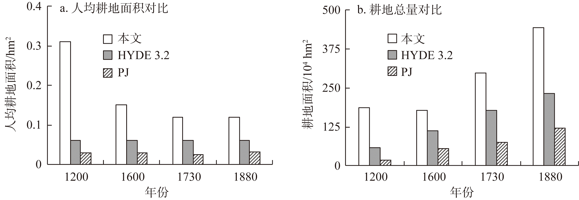
Comparison results of cropland area and per capita cropland area for Japan in 1200, 1600, 1730, and 1880 from global datasets and this study
Table 4
Relative discrepancy rate of cropland area and per capita cropland area at typical time points between global dataset and this study